

Knocknamaddree [Cnoc na Madrai]
Good walks are even better shared.
Overview
Knocknamaddree [Cnoc na Madrai]
Nestled in the heart of Munster, Knocknamaddree stands proudly at 546 meters, offering hikers a delightful jaunt through a landscape steeped in natural beauty and fascinating history.
Geology
The mountain is primarily composed of quartzite, which imparts a rugged charm to the terrain. Over the eons, glacial activity has sculpted the landscape into its current form, creating interesting geological features that would make any earth scientist raise an eyebrow—or a pint in celebration.
Routes
The Knocknamaddree Loop is the favourite route, stretching about 8.5 kilometers. This moderate trek offers both the casual hiker and the more experienced walker a pleasing mix of scenery. The loop will take around 3.5 hours, but make sure to leave some time for a breather—one can only yodel so much!
Summit Features
Upon reaching the summit, which features a quaint stone cairn, hikers are rewarded with a stunning 360-degree panorama. It’s the sort of view that would make even the most stoic of hikers feel invigorated.
Terrain
Expect a delightful mix of grassy knolls and rocky patches, interspersed with those charmingly unpredictable boggy areas that keep you on your toes—literally!
Views
From the summit, you’ll be treated to breathtaking sights of the Galtee Mountains and the serpentine flow of the River Mulcair. For the best views, plan your visit in late spring or early autumn when the weather is just right—neither too hot nor too foggy. You might even spot a distant sheep pretending to be a lookout!
Hazards
As with any adventure, there are a few warnings to heed. Be cautious of low visibility during fog, and do watch your step on wet rocks. Ticks can also be a concern in warmer months, so a quick check after your hike is wise.
Nearby Summits
If you’re up for more adventure, consider tackling Seefin or Lough Curra, both of which are nearby and offer their own unique landscapes to explore.
Access
Parking is available at the trailhead near Clogheen, making it easy to start your adventure. Public transport is limited, but if you can catch a bus from Clonmel, you’re set! Clogheen itself has basic facilities, though you may need to bring your own snack as the nearest cafes can be a distance away.
Conclusion
Whether you’re a seasoned mountaineer or just looking for a lovely Sunday hike, Knocknamaddree offers an accessible adventure perfect for those seeking a bit of solitude while surrounded by nature. And remember, no matter how tough the climb, the summit always makes it worthwhile!
Explore routes near Knocknamaddree [Cnoc na Madrai]
Public walks starting within 80 km of this hill. Nearby does not mean a route reaches the summit; check its map and access before setting out.
No public routes are currently listed within 80 km of Knocknamaddree [Cnoc na Madrai] on Walkmates. This does not mean there are no paths here. Explore the map and check local access information before planning a walk.
Route planning notes
These notes describe possible approaches, not verified navigable routes or permission to cross land. Check current paths, local access rules and conditions before setting out.
Knocknamaddree Loop
A scenic loop that takes hikers through lush valleys and up to the summit, providing diverse landscapes.
Make a day of it, together
Find someone to share the walk with, or organise a day out along a route you like.
Photo Gallery
View all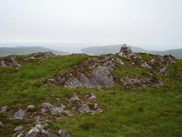 Photo could not load
V7829 : Knocknamaddree
Richard Webb
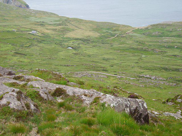 Photo could not load
V7829 : Northwestern side of Knocknamaddree
Richard Webb
Hill facts and local notes
Classifications
Elevation
313m
1,027 ft
Prominence
285m
Coordinates
51.5085, -9.7435
V790298
OS Map
88
At the Summit
The summit is characterized by a small stone cairn and a dramatic 360-degree view of the surrounding landscape.
Terrain & Geology
Primarily composed of quartzite, with areas of sandstone. The mountain showcases interesting geological features shaped by glacial erosion.
Views & Scenery
Spectacular views of the Galtee Mountains and the River Mulcair winding through the valleys below.
History & Heritage
Name Origin
Cnoc na Madrai translates to 'Hill of the Dogs', hinting at a potential canine connection local folklore.
Historical Significance
Holds cultural significance among local walkers and is a popular spot for hill-walking clubs.
Getting There & Facilities
Check current local access restrictions, parking rules and transport timetables before travelling. These notes do not confirm public access to the summit.
Parking
Parking available at the trailhead near Clogheen.
Public Transport
Limited bus service from Clonmel, check local schedules.
Nearby Facilities
Basic public toilets in Clogheen, but no cafes close to the trailhead.
Safety Information
Known Hazards
- Low visibility during foggy conditions, slippery rocks after rain, and potential for ticks in warmer months.
General Safety Tips
- Check weather conditions before setting out
- Carry appropriate clothing and equipment
- Let someone know your planned route
- Take a map, compass, and GPS device
- Carry emergency supplies: food, water, first aid kit, torch
Hills
Some common questions about the hills answered
Are there group walks up Knocknamaddree [Cnoc na Madrai]?
Many walkers use Walkmates to join or organise walks with others. You can check for group walks around Knocknamaddree [Cnoc na Madrai] through the maps
Are there other walkers around Knocknamaddree [Cnoc na Madrai]?
Activity varies by location and time, but Walkmates lets you see whether others have shared walks or shown interest in this area. Find other people through the walking friends search walking friends for Knocknamaddree [Cnoc na Madrai] search or of course create your own walk for Knocknamaddree [Cnoc na Madrai]
Can I organise a walk to Knocknamaddree [Cnoc na Madrai]?
Yes. If there aren’t any walks listed already, you can create a walk and make it available for others to join.
If you're signed up to Walkmates, you can create a walk to Knocknamaddree [Cnoc na Madrai].
How do I find a walk up this hill?
There are often multiple ways to walk this hill, depending on experience and route preference. Walkmates helps you explore walks and routes that others have shared.
Can I suggest a new route up Knocknamaddree [Cnoc na Madrai]?
Yes. You can suggest or create routes to share with others. Walkmates focuses on the social side of walking, so routes are used to help people organise walks and explore areas together, rather than as detailed navigation tools or route libraries.
Other uses really appreciate knowledgeable walkers sharing their routes. Share your favourite route to Knocknamaddree [Cnoc na Madrai] here
The is an error or something incorrect about this hill. How do I let you know?
We always strive to keep the information on Walkmates as accurate as possible. If you find an error, please let us know through the contact form and we'll aim to correct it as quickly as possible
Community Discussion
Comments
Location
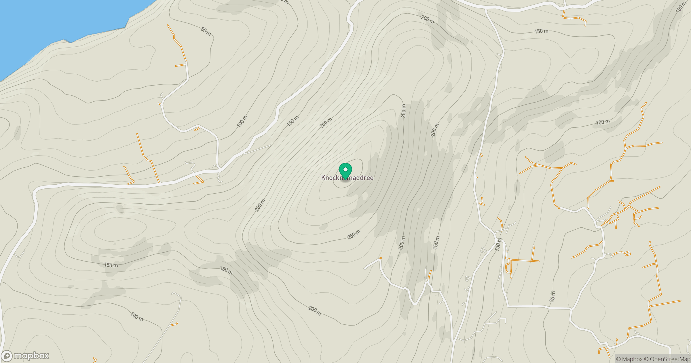
Grid reference: V790298
View on OpenStreetMapOpens a map in a new tab, centred on the hill.
Hills within 30 km
Straight-line distance, not a walking route or confirmation of access.
Knockaphuca [Cnoc an Phuca]
237m
Brow Head
108m
Caher Mountain [Cathair]
338m
Mizen Peak
232m
Ballyroon Mountain
239m
No comments yet. Be the first.